Package Name:com.veldscan.app
Show More

Satellite field scans for terrain anomalies and on-site checks.
VeldScan helps field teams and explorers analyze satellite-derived map layers to highlight candidate terrain anomalies for on-site verification.
What you can do:
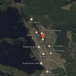
• Draw a scan area on satellite maps
• Review anomaly intensity heatmaps
• Switch data layers including Anomaly, Vegetation, and Moisture
• Use Optical, Radar, and Thermal scan sensors
• Use grid mode for structured field checks
• Open ranked analytical reports with top candidates
• Export or share PDF reports
Important: VeldScan results are candidate signals from remote sensing — not confirmation of buried structures. Always verify findings in the field.
Credits: advanced scans use credit packs purchased through Google Play.
Website: https://veldscan.com
Privacy: https://veldscan.com/privacy
Support: support@veldscan.com



One-click to install XAPK/APK files on Android!

Thanks for your rating and feedback!
You have already rated.